/02 · Interactive GIS / Discovery · 2026
Safaga GeoAtlas
From geographic records to a place worth exploring.
01THE CONTEXT
Location changes the decision.
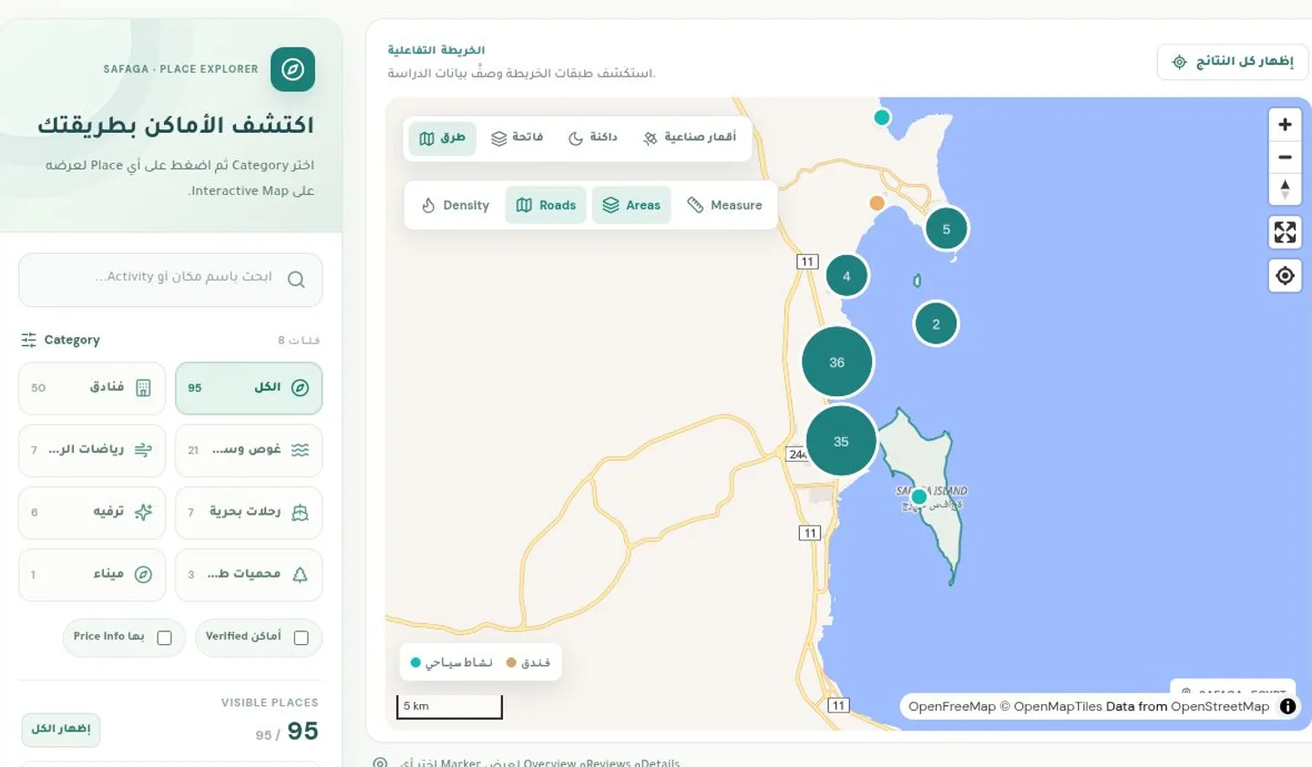
A list of hotels and activities is useful, but location changes the decision. Visitors need to see places together, narrow the options, and understand what is nearby without losing the original geographic context.
I built an Arabic-first discovery interface with an English option, combining a map explorer, place directory, analytics, and hotel-to-activity planning. The application uses bundled geographic data and runs without an application backend.
02UNDER THE SURFACE
How the pieces fit.
- 01GeoJSONLocal place records
- 02ReactFilters · Directory · Planner
- 03MapLibreMap layers · Selection · Clusters
03IMPLEMENTED WORKFLOWS
One dataset, several ways to explore
Map selection, category filters, text search, and a directory provide different entry points into the same geographic records.
Arabic & English
The interface supports both languages, including the layout considerations of Arabic-first content and English technical terminology.
Hotel-to-activity planning
The planner connects a selected hotel and activity, shows straight-line distance, and opens Google Maps for an actual route.
Data with context
Analytics summarize the bundled data. Selected review signals are dated, attributed snapshots rather than claims about live visitor traffic.
04ENGINEERING DECISIONS
Keep the application frontend-only.
The local GeoJSON is enough for filtering and discovery. External map tiles provide geographic context; there is no need for a custom database or application server for this scope.
Distance and directions are different.
A straight line helps compare nearby options. Actual travel distance depends on the route, so the interface hands navigation to Google Maps rather than presenting an estimate as a driving route.
Show what the source actually supports.
The project distinguishes regional photos, venue imagery, published review snapshots, and user-entered hotel quotes. It does not invent hotel prices or visitor counts.
05RESULT & SCOPE
What’s there today.
The live interface exposes the map, directory, analytics, and trip planner. Maps and optional overlays depend on third-party availability; satellite imagery requires an authorized MapTiler browser key.